Master of Environmental Studies
Evergreen's Master of Environmental Studies (MES) is an interdisciplinary degree that incorporates natural sciences, social sciences, traditional ecological knowledge, public policy and environmental humanities to prepare you for the complex nature of professional environmental work. As a Nationally Ranked Master's College, when you graduate, you’ll be ready to be an environmental leader.
Apply to MES
Applications Now Open!
Learn more about application requirements and timelines for the Fall 2026 cohort on our application page.
MES Program Overview
Environmental work naturally crosses disciplines. As a Master of Environmental Studies student, you’ll experience the Evergreen model of interdisciplinary programs where faculty teach together across disciplines. Your coursework will combine natural and social sciences, traditional ecological knowledge, as well as communication, policy and political advocacy. You’ll be able to create your own path, whether you enter with a clear goal or discover your passion along the way.
The program takes you from a core of interdisciplinary studies through electives and internships, up to a research thesis presented prior to graduation. You’ll work with a variety of faculty throughout your studies, including professionals in the field.
You’ll complete the program studying full-time for two years or studying part-time over three years, taking classes in the evenings. Your days will be open for work, internships, research and studying.
See specific courses in the Academic Catalog
Core Courses
32 Credits
One third of your credits will be in first-year core classes that cover environmental issues from a broad perspective. You’ll gain a foundation in key disciplines: ecology, economics, geography, climate studies, natural resource management and sustainability. Within these disciplines, you'll also develop skills in critical thinking, writing, research, quantitative analysis and research design.
Core Classes Model:
- Team-teaching with faculty from different disciplines
- Seminar sessions with in-depth discussions
- Hands-on learning, including labs and field trips
Electives & Internships
24 Credits
One third of your credits will be earned through a combination of electives and optional internship opportunities.
Electives
You can explore new interests or focus your degree on a specific subject area. Electives cover environmental studies topics in more detail. These courses are taught by faculty and environmental professionals beyond academia.
Internships
Most students also participate in internships. Internships are the best way to experience first-hand how your degree will translate into real-life experience. The program's schedule of evening classes makes it easier to complete an internship during the day.
Evergreen has long-standing relationships with state agencies and nonprofits that offer valuable internships where you'll develop new skills and make connections with professionals in the field.
Thesis
16 Credits
The final third of your credits will focus on designing, researching, writing and presenting your thesis.
In your final year, you'll take the last core class, Case Studies and Thesis Design, which provides a structure for thesis development. You'll also be matched with a faculty advisor to support you during the thesis process.
At the end of the program, you’ll present your results in a public form.
By completing a thesis, you’ll learn all the components of managing and analyzing research. Even if your professional life isn’t about research, the skills you gain will continue forward throughout your career.
MES Program Credit Overview
72 Total Credits
| MES Program Credits | |
|---|---|
| Program Parts | Credits |
| Core Courses | 32 |
| Electives and Individual Study | 24 |
| Thesis | 16 |
| Total Credits | 72 |
Career Paths
What can you do with your degree?
The best environmental solutions come from a wide variety of perspectives. Master of Environmental Studies students have a range of academic and life experiences, and alumni go on to many different careers.
Our graduates have:
- Developed and run nonprofit organizations
- Worked for national, state, local and Tribal governments
- Conducted resource management, research and policy development
- Taught environmental education and outreach
Many also pursue further study, earning Ph.D.s or additional professional degrees.
Learn more about our Distinguished Alumni
Possible Areas of Study
- Climate justice
- Environmental economics
- Environmental policy
- Freshwater ecology
- Energy policy
- Landscape management
- Science communication
- Ecofeminism
- Qualitative and quantitative statistical analysis
- Geographic Information Systems
- Restoration ecology
MES Information Sessions
Learn more about the Master of Environmental Studies program by attending a virtual information session.
Earn Your Degree at Your Own Pace
You’ll complete your Master of Environmental Studies studying full-time in two years or studying part-time in three years, taking classes in the evenings. Your days will be open for work, internships, research and studying.
Full-time
Two-year track
Year One
Fall Quarter
| Core course: Conceptualizing Our Regional Environment | 8 credits |
| Elective or individual study | 4 credits |
| Total credits | 12 credits |
| Total Master in Environmental Studies credits | 12 credits |
Winter Quarter
| Core course: Ecological & Social Sustainability | 8 credits |
| Elective or individual study | 4 credits |
| Total credits | 12 credits |
| Total Master in Environmental Studies credits | 24 credits |
Must advance to candidacy by completing the Candidacy Paper to continue to Spring Quarter
Spring Quarter
| Core courses: Research Design and Quantitative Methods | 8 credits |
| Elective or individual study | 4 credits |
| Total credits | 12 credits |
| Total Master in Environmental Studies credits | 36 credits |
Summer Quarter
Summer is a good time for internships and electives. Both of these options will count toward the required 24 total elective credits. Taking summer classes reduces the number of electives required in Year Two.
Year Two
Fall Quarter
| Core courses: Case Studies & Thesis Research Design | 8 credits |
| Elective or individual study | 4 credits |
| Total credits | 12 credits |
| Total Master in Environmental Studies credits | 48 credits |
Winter Quarter
| Core course: Thesis with workshop | 8 credits |
| Elective or individual study | 4 credits |
| Total credits | 12 credits |
| Total Master in Environmental Studies credits | 60 credits |
Spring Quarter
| Core course: Thesis with workshop | 8 credits |
| Elective or individual study | 4 credits |
| Total credits | 12 credits |
| Total Master in Environmental Studies credits | 72 credits |
Part-time
Three-year track
Year One
Fall Quarter
| Core course: Conceptualizing Our Regional Environment | 8 credits |
| Total credits | 8 credits |
| Total Master in Environmental Studies credits | 8 credits |
Winter Quarter
| Core course: Ecological & Social Sustainability | 8 credits |
| Total credits | 8 credits |
| Total Master in Environmental Studies credits | 16 credits |
Must advance to candidacy by completing the Candidacy Paper to continue to Spring Quarter
Spring Quarter
| Core courses: Research Design and Quantitative Methods | 8 credits |
| Total credits | 8 credits |
| Total Master in Environmental Studies credits | 24 credits |
Year Two
Students in this track have the option of taking case studies in Fall Quarter during the second or third year.
Fall Quarter
| Electives or individual study or case Studies & Thesis Design | 8 Credits |
| Total Credits | 8 Credits |
| Total MES Credits | 32 Credits |
Winter Quarter
| Electives or Individual Study | 8 Credits |
| Total Credits | 8 Credits |
| Total MES Credits | 40 Credits |
Spring Quarter
| Elective or Individual Study | 8 Credits |
| Total Credits | 8 Credits |
| Total MES Credits | 48 Credits |
Year Three
Students in a 3 year track, have the option of taking Case Studies in the Fall quarter of either their 2nd or 3rd year
Fall Quarter
| Electives or individual study or Case Studies & Thesis Design | 8 credits |
| Total credits | 8 credits |
| Total Master in Environmental Studies credits | 56 credits |
Winter Quarter
| Core Course: Thesis with workshop | 8 credits |
| Total credits | 8 credits |
| Total Master in Environmental Studies credits | 64 credits |
Spring Quarter
| Core Course: Thesis with workshop | 8 credits |
| Total credits | 8 credits |
| Total Master in Environmental Studies credits | 72 credits |
Certificate in Geographic Information Systems
Earn your Certificate in Geographic Information Systems while completing courses toward your graduate degree in the Master of Environmental Studies or Master of Public Administration programs!
Internships and Individual Study
As part of the required 24 elective credits, students may pursue internships or new learning in their current job for elective credit. Students in designing their own course that meets their unique academic and career goals can work with a faculty to design a self-driven course for elective credit.
Graduate Internships
Hands-on experiences
Internships
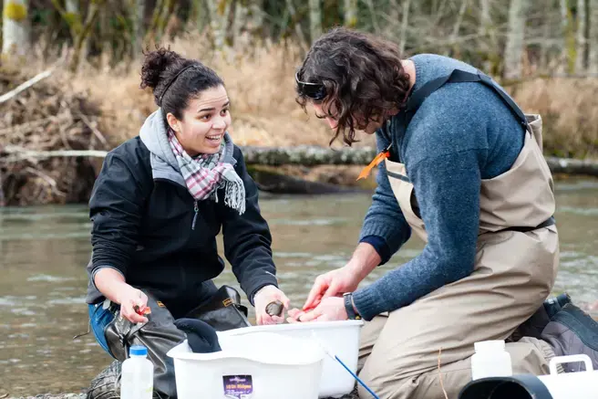
Internships are a key way to get useful experience and apply what you’re learning. Take advantage of our location and connections to expand your education beyond the classroom.
Find an Organization
If you haven't already made a connection, there are many options for Master in Environmental Studies internships.
- MES Weekly Blog and email announcements.
- Evergreen's Center for Community-Based Learning and Action
- You may also want to talk to your faculty or think about connections you’ve made in the community already.
The person you work with at an organization will be your field supervisor.
Plan What You Want to Learn
Together with your field supervisor, you’ll come up with a contract to describe the work you’ll be doing and how it connects to your graduate degree.
Find a Faculty Sponsor
At the same time, you’ll need to identify a faculty sponsor from the core faculty.
Register your Contract
Login to MyEvergreen, click on "Individual Learning Contracts", select a term and create a new contract. You will be guided through the process and then the contract will need to be electronically approved by the field supervisor, faculty sponsor and program staff.
No need to create a CRN or otherwise go through the normal online registration. All approvals must be completed by the fifth day of the quarter to avoid late registration fees.
Complete Additional Paperwork
All forms can be found on the Internships & Individual Study page
- Site agreement (for non-government agencies)
- Field supervisor approval
- Student waiver (print and sign, then submit to program staff)
See the Master in Public Administration handbook for details. When you set up your contract, you’ll also be told what additional forms you need to complete (if any).
Credits
You may earn up to eight credits toward your degree in any combination of internship or independent learning contract work. Internships may be paid or unpaid.
Ten hours per week will count for two credits. Twenty or more hours per week will count for four credits, the maximum amount allowed per quarter.
Graduate Independent Learning
Individual study options
Individual Study
Occasionally students develop their own curriculum with faculty to pursue independent research. You will need to work with a core faculty member to craft your learning objectives and guide your work. See the Master in Environmental Studies handbook for more information.
Credits
You may earn up to eight credits toward your degree in any combination of internship or independent learning contract work. Internships may be paid or unpaid.
Ten hours per week will count for two credits. Twenty or more hours per week will count for four credits, the maximum amount allowed per quarter.